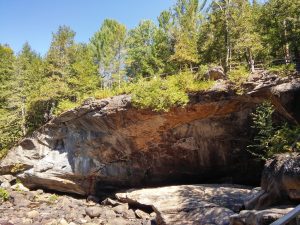
Natural Stone Bridge & Caves
I started writing about the Natural Stone Bridge and Caves in October, 2016. A few months ago, I had a dream that I had lost my souvenir pin and I had felt panicked in my dream. I revisited some photos and realized that I had tons of information already typed out about my adventure with my friend Michelle. Today, I finally had a moment and the mind to organize my story and the information with a few photos.
About an hour north driving from Saratoga Springs, New York, there is a unique geological feature within the Adirondack Mountains. CAVES!
I’m not sure if a lot of locals have been to this park or not, or if it’s more of a tourist thing, but I enjoyed myself and would recommend going there if you want an unusual, yet scenic hike with a lot of stairs.
They do provide walking sticks in the beginning if you are a person who has troubles navigating rocky terrain with a lot of stairs.
Growing Adirondack Mountains
- Young mountains made of old rock is how the Adirondacks are often characterized.
- The mountains are currently growing at 2-3mm/year, a very fast rate in geological terms. They are pushing up rock that was once buried over 10 miles beneath the surface and over a billion years old.
- The mountains look old because they were scraped bare by glaciers during the last ice age.
Marble Caves
- Unlike caves formed over millions of years through acidic water dissolving limestone, these caves are Grenville marble and were formed since the last ice age. Marble is formed when limestone is buried deep underground and the intense pressure and heat transforms it through a process called metamorphosis.
- This marble contains large calcite crystals that are dissolved by acidic waters and produce caves.
Michelle and I took a moment to take photos with the Caveman. Then we were off, excited to check out some caves!
 |
| Me and the Caveman. |
Michelle and I walked right past the Petrified Wood Display and Caveman Adventure Park and began our tour at Trout Brook, Point 4 on the Trail Guide. I missed taking photo of the Interpretive Sign here, and I noticed looking back at this adventure, the information on the Interpretive Signs is different than the information provided on the Trail Guide. I actually thought I took a photo, but I just as easily could have assumed at the beginning of our exploration that the signs and guide stated the same thing.
Trail Guide Point 4, “At the end of the last ice age the melting Wisconsin Glacier produced this once mighty river the formed the Natural Stone Bridge and Caves. The brook is now a usually tranquil waterway filled with many brook and rainbow trout, snapping turtles and the occasional beaver.”
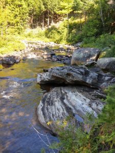 |
| Trout Brook. |
Following the trail we came across the Sawmill Waterfall Site, Point 5 on the Trail Guide. I remember looking for signs of the old structure and only finding a piece of wood from an old stair.
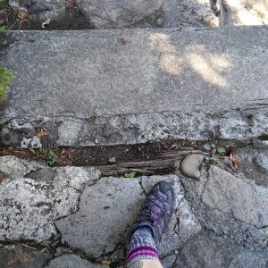 |
| My foot with the Sawmill remains. |
Trail Guide Point 5, “The waterfalls of Trout Brook provided the water wheel power for early Dutch pioneers to cut lumber and grind grain (1750-1910). The very last beam and some old stonework at your feet are all that remain.”
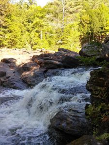 |
| Sawmill Waterfall. |
Interpretive Sign 5, “Logging in the Adirondacks– One of the main industries from 1800s until present, it reached its peak in 1905 when 700 million board feet were cut for use in construction and pulp.
Rivers were the method of choice for transporting timber. Truly a hazardous profession, approximately 200,000 logs were tallied along the Hudson River in 1904.”
“Remains of Sawmill Site– The early sawmill was built by Jacob VanBenthuysen (1764-1841). He received this property for service in the Revolutionary War and it has been in the family for over 200 years.”
“Logging Dam– The Stone Bridge Caves systems presented a problem for sending logs down Trout Brook and on to Schroon River. To prevent logs from getting jammed into the caves, the loggers would construct log dams to divert the water and logs. Unfortunately, many times the spring floods would overwhelm the dam and there are still a number of ancient logs preserved under the Stone Bridge.”
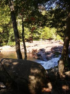 |
| View from Meditation Isle. |
When I finally moved my attention away from the waterfall, I turned around and saw the Stone Bridge. I honestly didn’t realize it yet because I was too absorbed in viewing the cave in front of me. The huge entrance to the marble cave was so magnificent, even in the blinding sun, it was difficult to look away from.
Trail Guide Point 6, “Your first spectacular view of the Natural Stone Bridge, discovered by Explorers in the 1600s.”
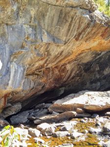 |
| View from Meditation Isle. |
Interpretive Sign 6, “The Natural Stone Bridge– Cavers have been mapping the caves (2003-2008) and have determined the Stone Bridge is the largest cave entrance in the East. At 166’ wide and 32’ high, it is massive. (Sign pointing to the stone bridge states 62’ high 180’ wide) It is the largest of the two main cave systems and contains an underground lake located right below the gift shop. These caves were formed during the retreat of the Wisconsin glacier approximately 10 to 13 thousand years ago. In geological terms these caves and formations are quite young and still changing.”
“Fiddlestring Falls– For over 100 years strings of water have been falling from the Stone Bridge. In 2006, something changed and much of the water is now flowing against the cave face and is depositing a reddish brown material. At first we were unsure what it was, but now we are certain that is flowstone containing some iron. In the winter, the water continues to flow and forms a large ice column every year.”
“Flowstone– These marble caves are called solutional because they are being dissolved by acidic water. Water that then contains dissolved calcium carbonate and other minerals can deposit onto the cave and are called speleothems. You may know them as stalactites, stalagmites and flowstone. Because these caves are so young and get washed out by high water, there are only a few examples.”
The path then takes you over the Stone Bridge. I must admit I didn’t know at this point that we were crossing over the Stone Bridge. Lookout Point, Point 7 on the Trail Guide, is the center point of crossing the Natural Stone Bridge. Looking down you wouldn’t know you were standing on top of a huge marble cave entrance!
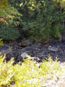 |
| Lookout Point. |
Lookout Point is where I basically where I lost what little control I had with my information gathering. My signs stopped matching up with my pictures at Point 8, The Giant’s Slide. I have a picture of the wood carved giant, but not the actual slide. If one was to look down a hole near this giant you would see water flowing under the stone bridge. Again, at this point I didn’t realize I was on the Stone Bridge.
 |
| The Giant. |
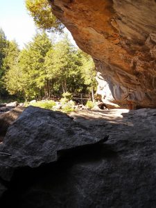 |
| View from below the Stone Bridge. |
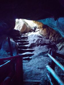 |
| Noisy Cave. |
After leaving the Noisy Cave, Point 10 on the Trail Guide, the path led over the cave, under Arch Rock. After going under the arch, which was awkwardly low, Michelle and I went down some stairs to a small cave where (one at a time) you could look down and see the water flowing through Noisy Cave.
The interpretive sign at Peter Pan’s Peephole, Point 11 on the Trail Guide, had a photo of a bat hanging in the cave. Perhaps it was the mention of bats that made me lose focus of gathering information. I am pretty sure Michelle said to me during this hike something akin to, “One would think with your dislike of mosquitoes and your love of vampires that you would be a huge fan of bats.”
Something about the geology of caves draws me to them. They pique a fascination in me, but the idea of bats in a cave truly gets the better of me.
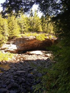 |
| The Natural Stone Bridge. |
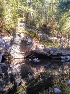 |
| Artist’s Gorge. |
My favorite part of the hike was the Artist’s Gorge.
Such stillness and reflection
the smallest movement of water dripping
rippled in vibrating colors
giving the area surrounding us
a kind of magic.
There were 20 Points on the Trail Guide. I thought I’d go through my photos one last time and see if I could add anymore.
Trail Guide Point 9, The Natural Stone Bridge
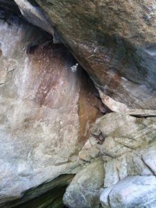 |
| Sunlight shining from Giant’s Slide against the cave wall under the Stone Bridge. |
Trail Guide Point 13, Serenity Point.
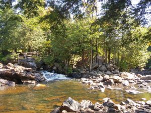 |
| View from Serenity Point. Sawmill Waterfall Site and Meditation Isle. |
Trail Guide Point 16, Indian Maidens Kettle. “One of the largest potholes in NY at over 30 feet across, it was formed by swirling waters from the ancient raging river.”
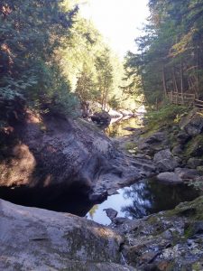 |
| View looking over Indian Maidens Kettle into Artist’s Gorge. Echo Cave is on the left. |
Geology of Natural Stone Bridge & Caves
September 22, 2016 – Pottersville, NY
There was a $14 entry fee for adults.
You can find current rates and hours at stonebridgeandcaves.com
All information shared here I gathered from the park trail guide or signs at different vantages throughout the park.
